BasinMaker
BasinMaker v3.1 is a set of Python-based GIS tools that support vector-based watershed delineation, rediscretization, simplification, and revision for complex watershed systems that may include thousands of stream and lakes. These tools are designed to manipulate the North American river and lake routing data product downloadable from this website.
BasinMaker can directly generate model discretization files for the Raven hydrological model framework, but may also be used to support drainage analysis or simulation with other vector-based hydrology models.
Routing Products
BasinMaker has been used to generate three publicly available routing products outlined below, which are shapefiles defining stream/lake network topology and characteristics of lakes and streams. In these products, each lake is represented by a lake catchment (subbasin). A lake catchment is defined by the following rules:
- the extent of the lake catchment will fully cover the lake;
- the outlet of the lake catchment is the same as the outlet of the lake; and
- each lake’s inlets are treated as a catchment outlet.
CLRH - the Canadian Lake-River Hydrofabric
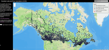
BasinMaker v3.1 was used to create a Canada-wide hydrofabric, with networks downloadable by region or by catchments upstream of points of interest such as Water Survey of Canada stream gauges. See the CLRH website for download and data specifications. Note also that BasinMaker can be applied in a CLRH-specific Google Colab environment to download and simplify CLRH networks.

Ontario Lake-River Routing Product (OLRRP) v1.0
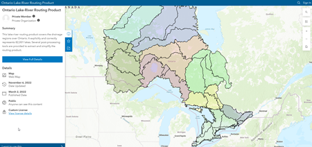
BasinMaker v3.0 was used to create this lake-river routing product covering the Province of Ontario based upon Ontario-specific terrain and hydrofeature data layers. See the OLRRP website to view and download the routing network.

North American Lake-River Routing Product (NALRRP) v2.1
BasinMaker v2.0 was utilized to create this lake-river routing product using the MERIT DEM (3 arcsec; ~0.0008333°; ~90m) and HydroLAKES as core input layers. The extent of the routing product covers the main drainage regions across North America (Canada and the USA).
Routing product data v2.1 can be accessed via the map-based download tool. Please use CLRH instead of NALRRP for any regions covered by both products.
Routing product users will want to download the data specifications file as well.
Authors
BasinMaker and the associated lake-river routing products were developed by the hydrology research group at the University of Waterloo. Primary Contributors includes Ming Han, Hongren Shen, Bryan A. Tolson, James R. Craig, Juliane Mai, Simon Lin, Nandita B. Basu, Frezer Awol. We also want to thank Robert Chlumsky, Étienne Gaborit, Hongli Liu, Konhee Lee for their secondary support in development of this product and their contributions to our Pan-Canadian routing product.
Contact
Please contact Ming Han regarding the BasinMaker and the routing products.
Citation
The BasinMaker manuscript is submitted for review. To cite BasinMaker software or the North American Lake-River Routing Product routing product, please use:
-
Han, M., H. Shen, B. A. Tolson, J. R. Craig, J. Mai, S. Lin, N. B. Basu, and F. Awol (2023). BasinMaker 3.0: a GIS toolbox for distributed watershed delineation of complex lake-river routing networks. Environmental Modelling and Software, 105688. doi:10.1016/J.ENVSOFT.2023.105688.
And if necessary, for the NALRRP dataset, cite:
-
Han, M., H. Shen, B. A. Tolson, J. R. Craig, J. Mai, S. Lin, N. B. Basu, F. Awol (2021). North American Lake-River Routing Product v2.1, derived by BasinMaker GIS Toolbox (routing product v2.1)
Support
Support for BasinMaker and the North American routing product development came from multiple sources:- Primary graduate student support for BasinMaker contributors was provided by NRCan/Canadian Forest Service G&C Grants #129677 and #129816 and Dr. Tolson's NSERC Discovery Grant.
- Secondary preliminary graduate student support for BasinMaker first author Ming Han was provided by Canada First Research Excellence Fund provided to the Lake Futures project of the Global Water Futures Project.
- Some additional secondary support was also provided via the CANARIE research software program, grant #RS3-124 to co-author Juliane Mai.

